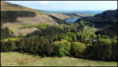
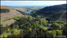
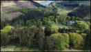
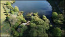
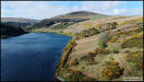
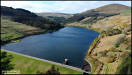
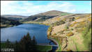
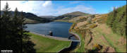
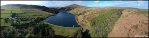
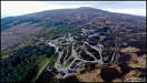
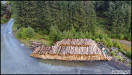
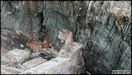
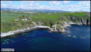
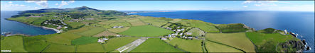
5th May
Injebreck Area.
DJI Spark
 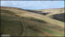  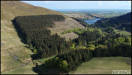 
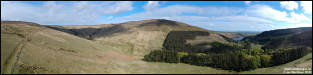 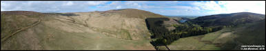
  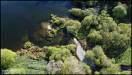  
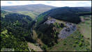
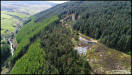
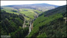
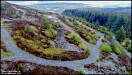
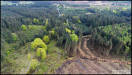
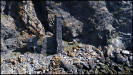
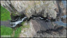
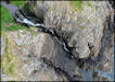
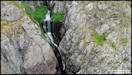
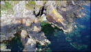
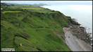
 7th May
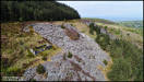
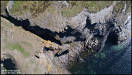
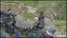
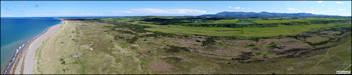
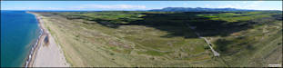
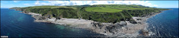
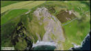
Glen Rushen Slate
Quarries
I first saw mention
of these quarries in Stan Basnett's excellent 'Hidden Places of Mann' book,
published in 1993 not long after I had arrived in the IOM and was still
finding my way around. I was re reading it last month while I was
away and thought that I'd take a visit for some aerial photography with
the drone from Arrysey Plantation. Stan mentions that there are great
views of the 5 levels of the quarry from a clearing in the plantation,
but things have changed over the years since then. Deciduous trees
have filled the clearing and removed most of the view so the drone was
helpful in getting a better look from above. The five levels are
also very hard to discern now, I suspect that natural erosion and the plantation
trees on the far side of the valley have obliterated many of them.
Looking at old maps, much of the length of the quarry has also vanished
amongst the trees. DJI Phantom 4 Pro
7th May
Glen Rushen Slate
Quarries
I first saw mention
of these quarries in Stan Basnett's excellent 'Hidden Places of Mann' book,
published in 1993 not long after I had arrived in the IOM and was still
finding my way around. I was re reading it last month while I was
away and thought that I'd take a visit for some aerial photography with
the drone from Arrysey Plantation. Stan mentions that there are great
views of the 5 levels of the quarry from a clearing in the plantation,
but things have changed over the years since then. Deciduous trees
have filled the clearing and removed most of the view so the drone was
helpful in getting a better look from above. The five levels are
also very hard to discern now, I suspect that natural erosion and the plantation
trees on the far side of the valley have obliterated many of them.
Looking at old maps, much of the length of the quarry has also vanished
amongst the trees. DJI Phantom 4 Pro
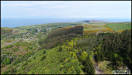    
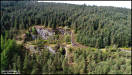 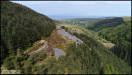   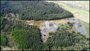
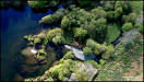
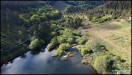
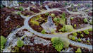
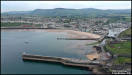
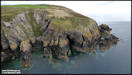
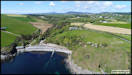
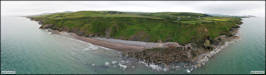
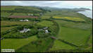
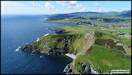
 10th May
South Barrule Quarry
and Plantation. DJI Phantom 4 Pro
10th May
South Barrule Quarry
and Plantation. DJI Phantom 4 Pro
   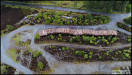
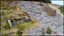
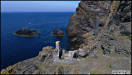
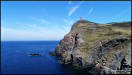
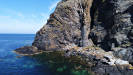
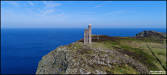
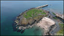
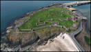
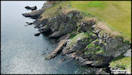
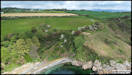
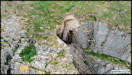
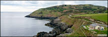
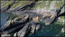
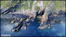
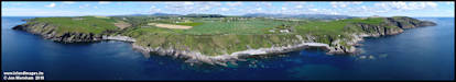
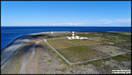
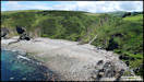
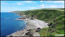
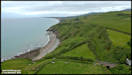
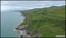
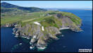
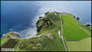
   15th May
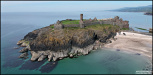
Bradda Head, flying
from the lower path that leads down to the old mines office of the South
Bradda Mine. Lead and copper were mined here, and the remains of
the old engine house and chimney stand at the base of the cliff which rises
to over 300ft above sea level, topped by Milner's Tower, constructed in
1871 in honour of William Milner, a wealthy safemaker from Liverpool and
benefactor to Port Erin. The mine closed in 1904.
DJI Phantom 4 Pro
15th May
Bradda Head, flying
from the lower path that leads down to the old mines office of the South
Bradda Mine. Lead and copper were mined here, and the remains of
the old engine house and chimney stand at the base of the cliff which rises
to over 300ft above sea level, topped by Milner's Tower, constructed in
1871 in honour of William Milner, a wealthy safemaker from Liverpool and
benefactor to Port Erin. The mine closed in 1904.
DJI Phantom 4 Pro
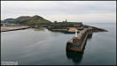
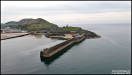
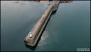
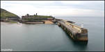
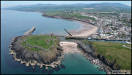
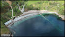
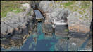
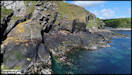
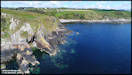
  Peel Beakwater, Castle
and the Fenella Beach. DJI Spark
Peel Beakwater, Castle
and the Fenella Beach. DJI Spark
  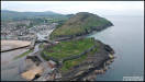  
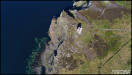
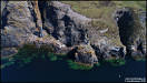
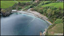
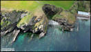
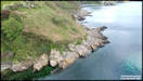
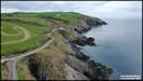
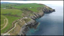
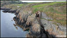
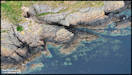
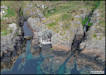
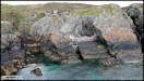
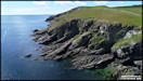
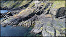
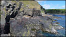
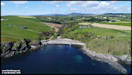
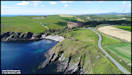
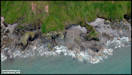
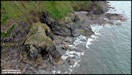
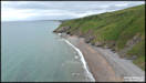
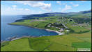
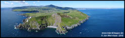
    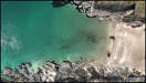 19th May
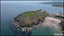
Port Soderick.
DJI Spark
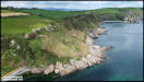
19th May
Port Soderick.
DJI Spark
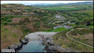
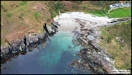
     Groudle. DJI Spark
19/5/19
Groudle. DJI Spark
19/5/19
   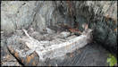 
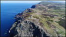
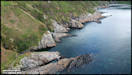
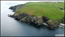
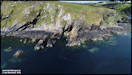
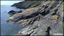
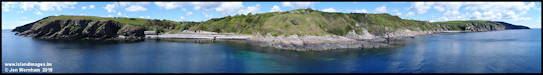
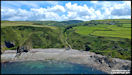
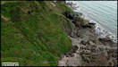
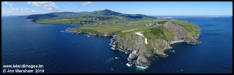
 2ist May
Port Soderick revisited
using the Phantom 4, with the specific intention of looking for remains
of the old southern walkways along the cliffs before they completely disappear.
The first set of pictures concentrate on this area, followed by a couple
of panoramas stitched from multiple images, then some more general photography
in the area.
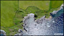
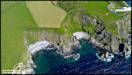
2ist May
Port Soderick revisited
using the Phantom 4, with the specific intention of looking for remains
of the old southern walkways along the cliffs before they completely disappear.
The first set of pictures concentrate on this area, followed by a couple
of panoramas stitched from multiple images, then some more general photography
in the area.
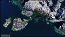
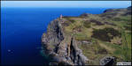
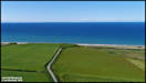
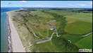
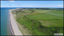
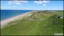
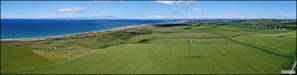
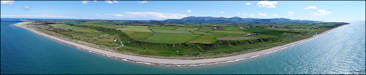
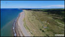
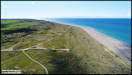
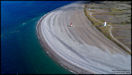
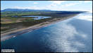
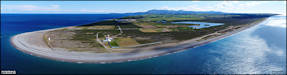
 6th June
Three locations around
The Ayres. DJI Phantom 4
This is apparently
the newest part of the Isle of Man at around 5,000 years old,band is technically
known as a 'raised beach', indeed from Blue Point you can see the old cliff
line running inland. It is an area of grass covered duneland and
much of it isdesignated as a nature reserve.
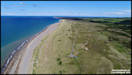
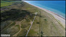
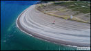
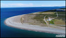
Blue Point
6th June
Three locations around
The Ayres. DJI Phantom 4
This is apparently
the newest part of the Isle of Man at around 5,000 years old,band is technically
known as a 'raised beach', indeed from Blue Point you can see the old cliff
line running inland. It is an area of grass covered duneland and
much of it isdesignated as a nature reserve.
Blue Point
    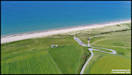
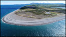
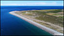
  Rue Point
  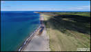  
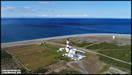
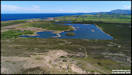
  The Point of Ayre
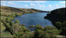
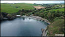
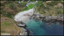
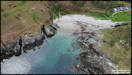
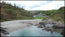
 9th June
Glen Maye Beach
- DJI Spark
9th June
Glen Maye Beach
- DJI Spark
 13th June
Lhiannag -
DJI Spark
13th June
Lhiannag -
DJI Spark
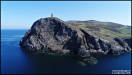
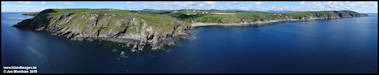
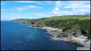
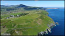
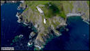
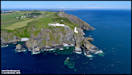
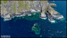
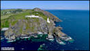
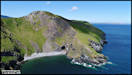
   18th June
Maughold Head Area.
- DJI Phantom 4 Pro
18th June
Maughold Head Area.
- DJI Phantom 4 Pro
  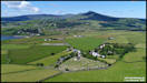 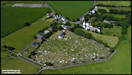 
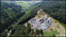
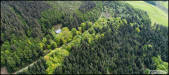
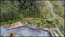
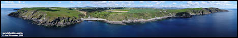
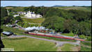
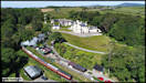
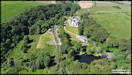
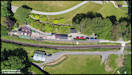
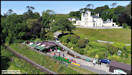
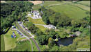
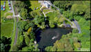
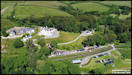
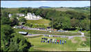
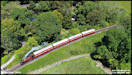
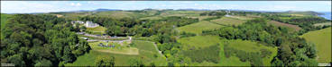
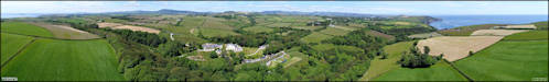
 22nd June
Crogga House - Open
day on the Crogga Valley Railway - DJI Phantom 4 Pro
22nd June
Crogga House - Open
day on the Crogga Valley Railway - DJI Phantom 4 Pro
|
